Drone imagery, visual inspection and photogrammetry
Aerial photography, film and 3D capture for buildings, industrial sites, infrastructure and construction. newpic photography plans the capture around your task: presenting a location, documenting its condition or creating a spatial model.
Aerial views reveal relationships that are difficult to see from the ground. For technical applications, we first establish which details your subsequent assessment needs.
Industrial sites and production halls
overviews for communications and documentation.
Telecommunications and broadcasting towers
visual records of hard-to-reach components.
Roofs and solar installations
imagery to support planning and documentation.
Construction sites and progress
visual records using agreed viewpoints.
Photogrammetry, 3D mapping, spatial models and digital twins for the intended application.
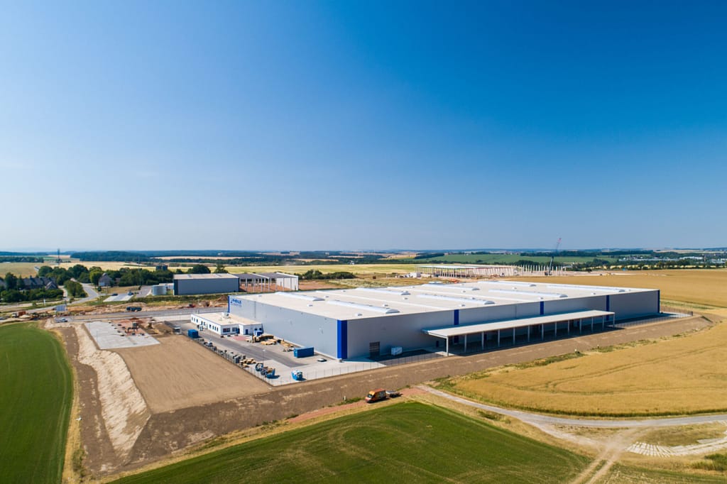
Aerial photography and site overviews
The existing portfolio shows real aerial photography. It is not evidence of a technical inspection, measured model or expert assessment.
Presentation and overview: aerial imagery for communications and site context.
Visual condition documentation: agreed viewpoints for observable details and progress.
Spatial models: photogrammetry, 3D mapping and digital twins for the intended application.
Define the result before the flight
Tell us about the object, location, access, timing and intended result. Formats and any required measurement references are agreed before commissioning.
Airspace, weather, permissions, privacy, safety and technical suitability determine feasibility. Neither a flight at every location nor a particular level of measurement accuracy is promised as standard. Toni Kretschmer is your contact for projects across Europe and worldwide.
Application illustrations
The following application images are AI-generated concept visualisations. They do not depict completed client projects.
AI-generated visualisation. This does not depict a completed client project.
AI-generated visualisation. This does not depict a completed client project.
AI-generated visualisation. This does not depict a completed client project.
AI-generated visualisation. This does not depict a completed client project.
Frequently asked questions
Does a drone inspection replace an expert assessment?
No. Visual imagery records observable conditions and can support a specialist assessment. It does not, by itself, constitute an expert report or certification.
Can you operate at every location?
No. The task and local conditions must allow a safe operation. Feasibility is checked for each project.
Do you offer thermal imaging or searches for roe deer fawns?
No. Thermal imaging and searches for roe deer fawns are not offered.
What would you like to document?
Describe the object, location and intended result. We will assess the suitable capture method and feasibility for the project.